![]()
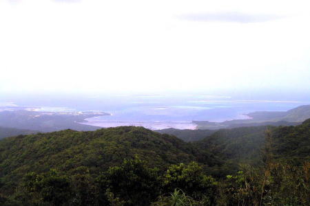 |
| A view from the top of Mt. Tedou (Funaura Bay) |
Mt. Tedou is located southward from Funaura Bay, also being near to the main stream of Urauchi River. It is 411.5 meters above, being close to the height of Mt. Komi which is the highest mountain in Iriomote Island.
"Tedou" means "Taketomi", it is originated from a fact that this area is a common land for people in Taketomi Island and there they used to fetch wood and hunt since the old days. Similarly, there are mountains such as Patuma(Hatoma)-muri and Patiran(Hateruma)-muri, inferring that Iriomote Island provided benefit to the people in adjacent islands since the old days.
To the top of Mt. Tedou, we have a clear route. It starts from facilities of the catchment basin of Mare River (called the pump shack), which also is the starting point for a canoe tour to Pinaisara. That route diverged into another route to upper fat of Pinaisara (with a guidance plate at the divergent point), for the top of Mt. Tedou, it takes about 3 hours from the pump shack. The route is clear in general; however in some places, we may have difficulties in route finding from open spaces and have some continuous steep slopes. Further, we should carry enough water to drink with us because there is no place to supply water in the route.
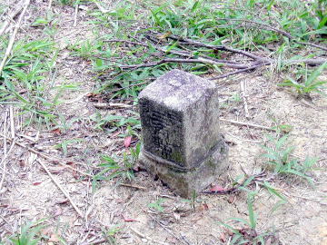
There is an open space with about 4 rooms width at the top of Mt. Tedou, a stone indicating a level point is placed there. The route to the mountain top further continues and we can get to Urauchi River. The exit point is in the promenade between Gunkan-iwa (warship rock) and Kanbire Falls, being slightly before Kanbire Falls; however it is difficult to find the route because very few people pass. In former days, when crossing the island, some strong people utilized the route that they got to the crossing route through Mt. Tedou in order to save the charges of sightseeing boat of Urauchi River. It may be interesting to take such a route if you are planing several camping stays in the mountains.
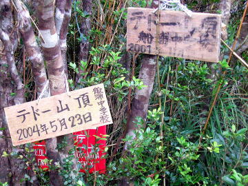
Mt. Tedou is sometimes utilized as an "excursion" course for junior high school students of the island, so we can see some their memorial plates for climbing at the top of the mountain. However, about half of their parents who climbed the mountain for maintenance of the route fell in groggy. It cannot be a casual hiking course but it should be a maniac place for which much stamina is required. The fact that such a place can be the "excursion" course would be suitable for Iriomote.
 |
 |
|
| A level point at the top of Mt. Tedou |
|
![]()
![]()